
Datei:Map elbe mouth 1910.jpg
Zur Navigation springen
Zur Suche springen

Größe dieser Vorschau: 800 × 494 Pixel. Weitere Auflösungen: 320 × 198 Pixel | 640 × 396 Pixel | 1.024 × 633 Pixel | 1.500 × 927 Pixel
Originaldatei (1.500 × 927 Pixel, Dateigröße: 787 KB, MIME-Typ: image/jpeg)
![]()
Diese Datei und die Informationen unter dem roten Trennstrich werden aus dem zentralen Medienarchiv Wikimedia Commons eingebunden.
![]()
Beschreibung
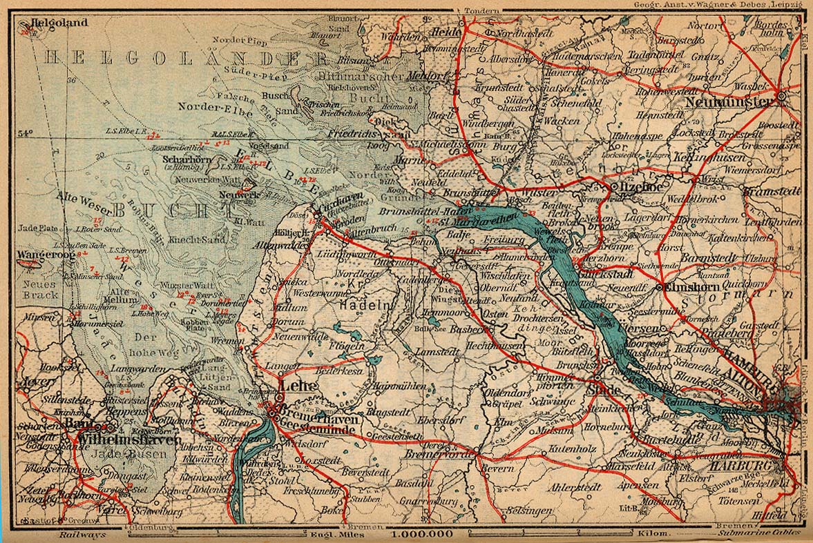
| Beschreibung | Mouth of Elbe |
| Datum | |
| Quelle | http://www.lib.utexas.edu/maps/historical/baedeker_n_germany_1910/elbe_mouth_1910.jpg |
| Urheber | "Northern Germany as far as the Bavarian and Austrian Frontiers; Handbook for Travellers" by Karl Baedeker. Fifteenth Revised Edition. Leipzig, Karl Baedeker; New York, Charles Scribner's Sons 1910. |
| Genehmigung (Weiternutzung dieser Datei) |
"Courtesy of the University of Texas Libraries, The University of Texas at Austin." http://www.lib.utexas.edu/maps/map_sites/hist_sites.html |
Lizenz
|
Dieses Werk ist Gemeinfreiheit11, weil seine urheberrechtliche Schutzfrist abgelaufen ist. | |
| Es wurde festgestellt, dass diese Datei frei von bekannten Beschränkungen durch das Urheberrecht ist, alle verbundenen und verwandten Rechte eingeschlossen. | |
Dateiversionen
Klicke auf einen Zeitpunkt, um diese Version zu laden.
| Version vom | Vorschaubild | Maße | Benutzer | Kommentar | |
|---|---|---|---|---|---|
| aktuell | 10:25, 16. Nov. 2023 | | 1.500 × 927 (787 KB) | Ratzer | bessere Auflösung: https://wardmapsgifts.com/collections/northern-germany-1925/products/elbe-river-delta-region-germany-1925 |
| 03:02, 25. Apr. 2006 |  | 1.176 × 787 (713 KB) | 700 MB | cut off the scan background | |
| 02:52, 25. Apr. 2006 |  | 1.177 × 787 (681 KB) | 700 MB | tried to remove the stain | |
| 01:34, 23. Apr. 2006 |  | 1.177 × 787 (371 KB) | 700 MB | {{Information| |Description=Mouth of Elbe |Source=http://www.lib.utexas.edu/maps/historical/baedeker_n_germany_1910/elbe_mouth_1910.jpg |Date=1910 |Author="Northern Germany as far as the Bavarian and Austrian Frontiers; Handbook for Travellers" by Karl Ba |
Dateiverwendung
Die folgenden 6 Seiten verwenden diese Datei:
Globale Dateiverwendung
Die nachfolgenden anderen Wikis verwenden diese Datei:
- Verwendung auf en.wikipedia.org
- Verwendung auf nds.wikipedia.org
- Verwendung auf www.wikidata.org