
Datei:1855 Colton Map or City Plan of Paris, France - Geographicus - Paris-c-55.jpg
Zur Navigation springen
Zur Suche springen
Größe dieser Vorschau: 734 × 600 Pixel. Weitere Auflösungen: 294 × 240 Pixel | 588 × 480 Pixel | 940 × 768 Pixel | 1.253 × 1.024 Pixel | 2.507 × 2.048 Pixel | 3.000 × 2.451 Pixel
Originaldatei (3.000 × 2.451 Pixel, Dateigröße: 2,84 MB, MIME-Typ: image/jpeg)
![]()
Diese Datei und die Informationen unter dem roten Trennstrich werden aus dem zentralen Medienarchiv Wikimedia Commons eingebunden.
![]()
| J. H. Colton: The Environs of Paris
( |
|||||||||||||||||||||
|---|---|---|---|---|---|---|---|---|---|---|---|---|---|---|---|---|---|---|---|---|---|
| Künstler |
|
||||||||||||||||||||
| Titel |
The Environs of Paris |
||||||||||||||||||||
| Beschreibung |
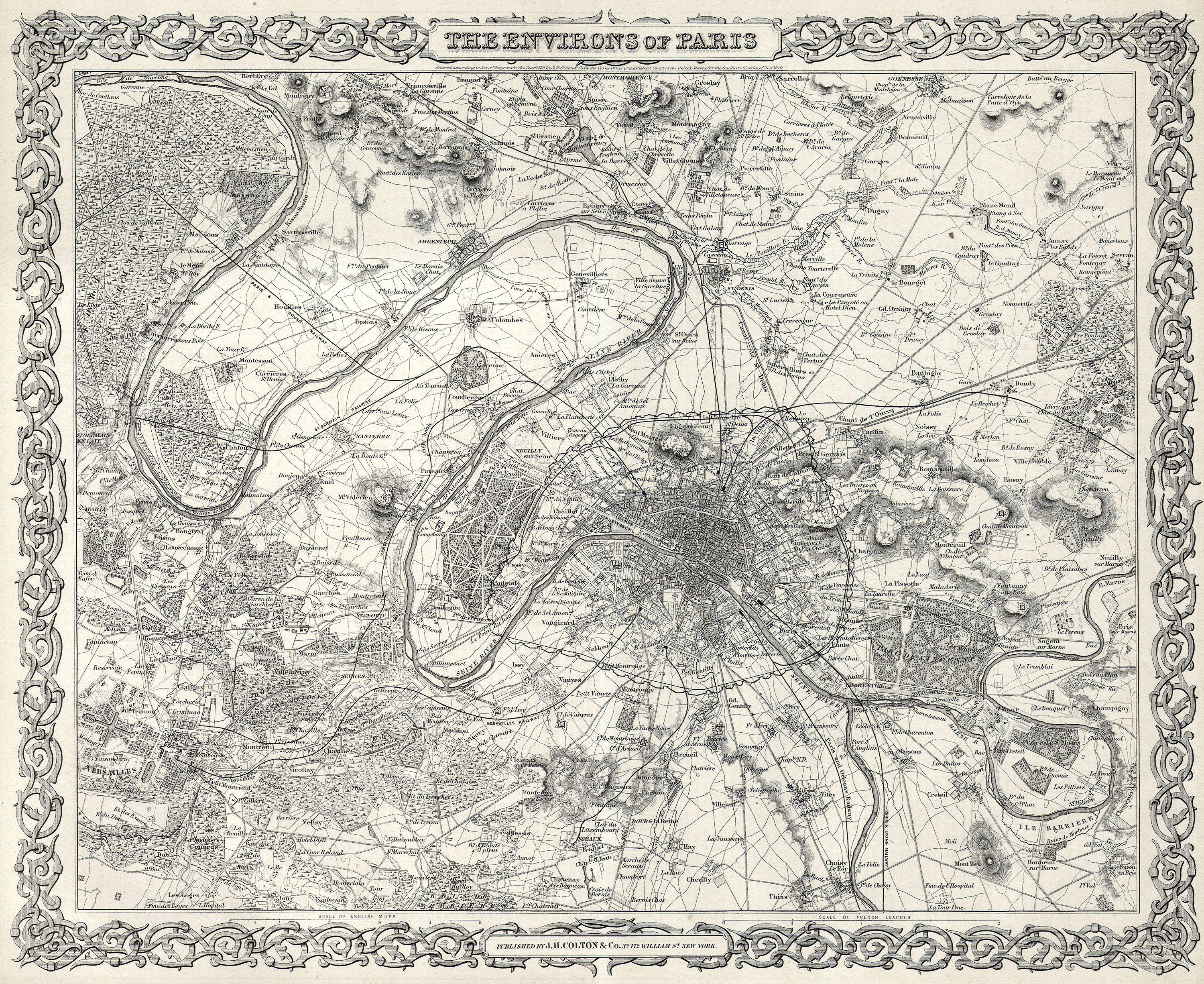
English: This rare hand colored map of Paris and Environs is a copper plate engraving dating to 1855. Produced by the respected mid 19th century American Mapmaker J. H. Colton. Map covers the Seine valley in a roughly 30 mile radius of Paris. Versailles appears in the extreme southwest and Vitry in the extreme northeast. The whole is beautifully detailed down to individual buildings. A beautiful and superbly detailed map. |
||||||||||||||||||||
| Datum | 1855 | ||||||||||||||||||||
| Maße | Höhe: 13 in (33 cm); Breite: 16 in (40,6 cm) | ||||||||||||||||||||
| Inventarnummer |
Geographicus link: Paris-c-55 |
||||||||||||||||||||
| Herkunft/Fotograf |
|
||||||||||||||||||||
| Genehmigung (Weiternutzung dieser Datei) |
|
||||||||||||||||||||

Dateiversionen
Klicke auf einen Zeitpunkt, um diese Version zu laden.
| Version vom | Vorschaubild | Maße | Benutzer | Kommentar | |
|---|---|---|---|---|---|
| aktuell | 04:38, 25. Mär. 2011 | | 3.000 × 2.451 (2,84 MB) | BotMultichillT | {{subst:User:Multichill/Geographicus |link=http://www.geographicus.com/P/AntiqueMap/Paris-c-55 |product_name=1855 Colton Map or City Plan of Paris, France |map_title=The Environs of Paris |description=This rare hand colored map of Paris and Environs is a |
Dateiverwendung
Die folgende Seite verwendet diese Datei:
Globale Dateiverwendung
Die nachfolgenden anderen Wikis verwenden diese Datei:
- Verwendung auf en.wikipedia.org
- Verwendung auf fr.wikipedia.org