
Datei:Tasmania in Australia map.png
Zur Navigation springen
Zur Suche springen
Es ist keine höhere Auflösung vorhanden.
Tasmania_in_Australia_map.png (200 × 186 Pixel, Dateigröße: 11 KB, MIME-Typ: image/png)
![]()
Diese Datei und die Informationen unter dem roten Trennstrich werden aus dem zentralen Medienarchiv Wikimedia Commons eingebunden.
![]()
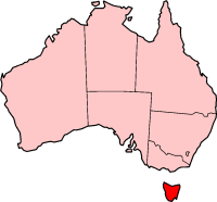
Localization of Tasmania in Australia

|
Es ist erlaubt, die Datei unter den Bedingungen der GNU-Lizenz für freie Dokumentation, Version 1.2 oder einer späteren Version, veröffentlicht von der Free Software Foundation, zu kopieren, zu verbreiten und/oder zu modifizieren; es gibt keine unveränderlichen Abschnitte, keinen vorderen und keinen hinteren Umschlagtext.
Der vollständige Text der Lizenz ist im Kapitel GNU-Lizenz für freie Dokumentation verfügbar. |
| Diese Datei ist unter der Creative-Commons-Lizenz „Namensnennung – Weitergabe unter gleichen Bedingungen 3.0 nicht portiert“ lizenziert. | ||
| ||
| Diese Lizenzmarkierung wurde auf Grund der GFDL-Lizenzaktualisierung hinzugefügt. |

|
File:Tasmania in Australia.svg ist eine vektorisierte Version dieses Bildes. Diese sollte an Stelle des Rasterbildes verwendet werden, sofern sie nicht schlechter ist.
File:Tasmania in Australia map.png → File:Tasmania in Australia.svg
Für weitere Informationen siehe Help:SVG. |
 |
History on English Wikipedia
- (delete all) (current) 23:20, 22 February 2004 Morwen (Talk | contribs | block) 200×186 11 KB
- (delete this) (revert) 08:45, 10 May 2003 Tim Starling (Talk | contribs | block) 200×181 4 KB Created by me based on Geoscience Australia data
Dateiversionen
Klicke auf einen Zeitpunkt, um diese Version zu laden.
| Version vom | Vorschaubild | Maße | Benutzer | Kommentar | |
|---|---|---|---|---|---|
| aktuell | 17:08, 12. Dez. 2004 | | 200 × 186 (11 KB) | Mschlindwein | Localization of Tasmania in Australia |
Dateiverwendung
Keine Seiten verwenden diese Datei.
Globale Dateiverwendung
Die nachfolgenden anderen Wikis verwenden diese Datei:
- Verwendung auf en.wikipedia.org
- Coat of arms of Tasmania
- List of highways in Tasmania
- James Boag's Premium
- Tasmanian Conservation Trust
- Butlers Gorge Power Station
- Tasmania 40° South
- Colonial Secretary of Tasmania
- Office of the Tasmanian Economic Regulator
- Anthony Fenn Kemp
- Agfest
- Mona Foma
- William Collins (colonist)
- Grecian (1824 ship)
- Cygnet Folk Festival
- Tasmanian Freight Equalisation Scheme
- Template:Tasmania-stub
- Bulbine crassa
- Currie Lighthouse
- Goose Island Lighthouse
- Electoral division of Westmorland
- Lune River, Tasmania
- Tasmanian University Football Club
- 2014 Tasmanian Legislative Council periodic election
- Tasmanian Electoral Commission
- Hope and Anchor Tavern
- Gormanston railway station, Tasmania
- 2015 Tasmanian Legislative Council periodic election
- Tasmanian Central Highlands
- Tasmanian Northern Midlands
- Tasmanian Northern Slopes
- Tasmanian West
- Tasmanian South East
- Tasmanian Southern Ranges
- King bioregion
- Ben Lomond bioregion
- Nieterana Power Station
- Deal Island Lighthouse
- Furneaux bioregion
- Tasmanian Government Personal Information Card
- 2018 Hobart floods
- Patterdale and Nile Farm
- Tasdance
- Lea Tree
- Solicitor-General of Tasmania
- Verwendung auf hif.wikipedia.org
- Verwendung auf hu.wikipedia.org
- Verwendung auf id.wikipedia.org
- Verwendung auf ja.wikipedia.org
- Verwendung auf sw.wikipedia.org
- Verwendung auf www.wikidata.org