
Datei:Mexico Chihuahua location map.svg
Zur Navigation springen
Zur Suche springen

Größe der PNG-Vorschau dieser SVG-Datei: 532 × 600 Pixel. Weitere aus SVG automatisch erzeugte PNG-Grafiken in verschiedenen Auflösungen: 213 × 240 Pixel | 426 × 480 Pixel | 681 × 768 Pixel | 908 × 1.024 Pixel | 1.817 × 2.048 Pixel | 2.176 × 2.453 Pixel
Originaldatei (SVG-Datei, Basisgröße: 2.176 × 2.453 Pixel, Dateigröße: 805 KB)
![]()
Diese Datei und die Informationen unter dem roten Trennstrich werden aus dem zentralen Medienarchiv Wikimedia Commons eingebunden.
![]()
W3C-validity not checked.
| Beschreibung |
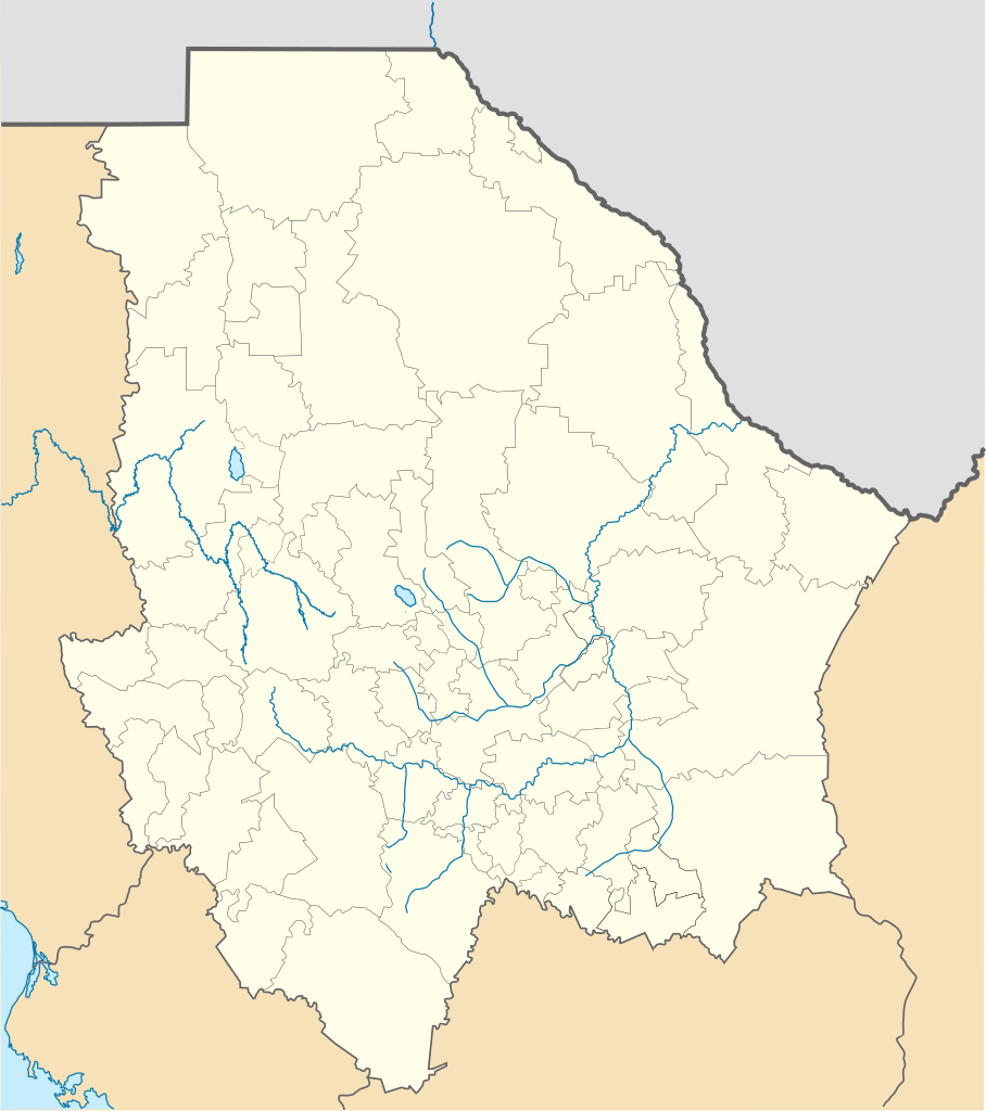
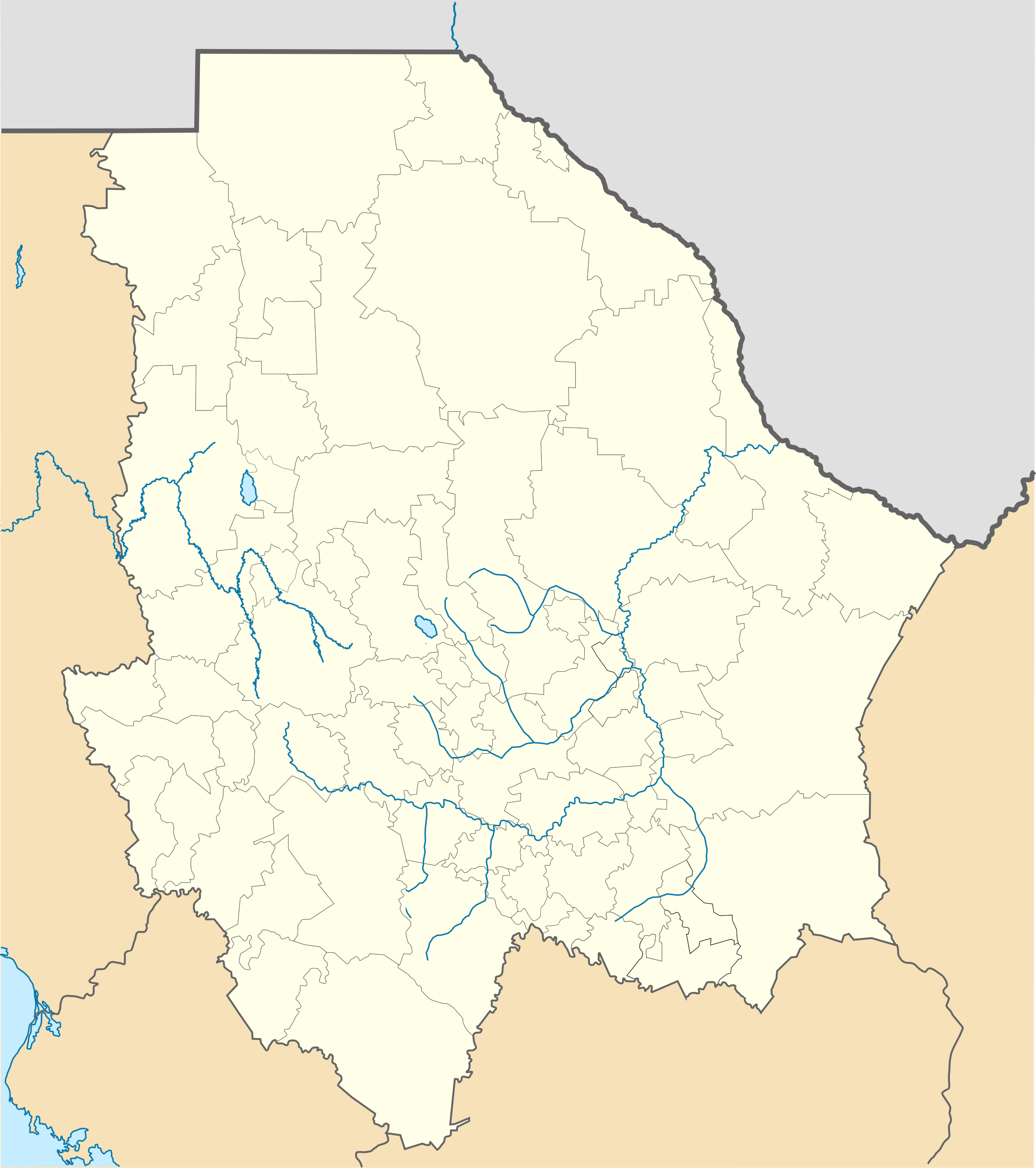
Location Map of Chihuahua Equirectangular projection, Geographic limits of the map:
|
| Datum | |
| Quelle | Eigenes Werk |
| Urheber | Battroid (talk) |
Ich, der Urheber dieses Werkes, veröffentliche es unter der folgenden Lizenz:
| Ich, der Urheberrechtsinhaber dieses Werkes, veröffentliche es als gemeinfrei. Dies gilt weltweit. In manchen Staaten könnte dies rechtlich nicht möglich sein. Sofern dies der Fall ist: Ich gewähre jedem das bedingungslose Recht, dieses Werk für jedweden Zweck zu nutzen, es sei denn, Bedingungen sind gesetzlich erforderlich. |
Dateiversionen
Klicke auf einen Zeitpunkt, um diese Version zu laden.
| Version vom | Vorschaubild | Maße | Benutzer | Kommentar | |
|---|---|---|---|---|---|
| aktuell | 01:15, 5. Nov. 2012 | | 2.176 × 2.453 (805 KB) | Battroid | {{ValidSVG}} {{Information |Description=Location Map of Chihuahua Equirectangular projection, Geographic limits of the map: * N: 32.03° N * S: 25.45° N * W: 109.47° W * E: 102.82° W |Source={{own work}} |Date=2011-08-21 |Author=[[... |
| 09:06, 5. Mär. 2012 |  | 2.176 × 2.453 (728 KB) | Battroid | {{ValidSVG}} {{Information |Description=Location Map of Chihuahua Equirectangular projection, Geographic limits of the map: * N: 32.03° N * S: 25.45° N * W: 109.47° W * E: 102.82° W |Source={{own work}} |Date=2011-08-21 |Author=[[... | |
| 21:44, 21. Aug. 2011 |  | 2.176 × 2.453 (721 KB) | Battroid | {{ValidSVG}} {{Information |Description=Location Map of Chihuahua Equirectangular projection, Geographic limits of the map: * N: 32.03° N * S: 25.45° N * W: 109.47° W * E: 102.82° W |Source={{own work}} |Date=2011-08-21 |Author=[[Use |
Dateiverwendung
Die folgenden 20 Seiten verwenden diese Datei:
- Barranca del Cobre
- Batopilas
- Casas Grandes
- Cerro Mohinora
- Chihuahua (Stadt)
- Ciudad Juárez
- Creel
- Cuauhtémoc (Chihuahua)
- Estadio Monumental Chihuahua
- Estadio Olímpico Benito Juárez
- Estadio Olímpico Universitario José Reyes Baeza
- Meoqui
- Naica
- Nationalpark Cumbres de Majalca
- Nuevo Casas Grandes
- Ojinaga
- Parral (Chihuahua)
- Valle de Allende
- Wikipedia:Kartenwerkstatt/Positionskarten/Nordamerika
- Vorlage:Positionskarte Mexiko Chihuahua
Globale Dateiverwendung
Die nachfolgenden anderen Wikis verwenden diese Datei:
- Verwendung auf ar.wikipedia.org
- Verwendung auf bg.wikipedia.org
- Verwendung auf ceb.wikipedia.org
- Verwendung auf ce.wikipedia.org
- Verwendung auf en.wikipedia.org
- Copper Canyon
- Ciudad Juárez
- Parral, Chihuahua
- Ciudad Madera
- Camargo, Chihuahua
- Chihuahua International Airport
- Ciudad Juárez International Airport
- Delicias, Chihuahua
- Batopilas, Chihuahua
- User:Stone/MPS
- Lake Arareco
- Puerto Palomas, Chihuahua
- Batopilas Municipality
- Santa Bárbara, Chihuahua
- Ascensión, Chihuahua
- Guachochi
- Carichí
- Témoris
- Huejotitán
- Mariano Matamoros, Chihuahua
- San Francisco de Conchos
- Moris, Chihuahua
- Temósachic
- San Francisco Javier de Satevó
- Battle of Ciudad Juárez (1911)
- El Paso–Juárez
- Cerro Mohinora
- Basúchil
- Samalayuca Dune Fields
- Module:Location map/data/Mexico Chihuahua/doc
- Yepachic
- Colonia Díaz
- Nuevo Casas Grandes Municipal Airport
- Module:Location map/data/Mexico Chihuahua
- User:Ty654/List of earthquakes from 1920-1929 exceeding magnitude 6+
- Aeroclub Manitoba Airfield
- Santa Gertrudis Air Force Base
- Ejido el Vergel, Chihuahua
Weitere globale Verwendungen dieser Datei anschauen.